
The Cheltenham Badlands are one of the most unusual and visually striking landscapes in southern Ontario. Their smooth, rust-red hills and deeply carved erosion channels create an almost otherworldly scene, especially when contrasted with the surrounding green forests of Caledon.
Located near the village of Cheltenham, the site exposes ancient layers of rock known as Queenston Shale, formed more than 445 million years ago. However, the dramatic “badlands” landscape visible today is much younger. It developed after vegetation was removed and agricultural activity—particularly livestock grazing—accelerated the erosion of the soft shale beneath the surface.
Today, the Cheltenham Badlands are protected as a significant geological site and designated as an Earth Science Area of Natural and Scientific Interest (ANSI), representing an important part of Ontario’s natural heritage.
How Were the Cheltenham Badlands Formed?
Ancient Rocks Dating Back Hundreds of Millions of Years
The geological story of the Cheltenham Badlands begins around 445 million years ago, during the Late Ordovician period.
At that time, southern Ontario was very different from today. The region was part of a shallow marine environment where sediments eroded from ancient mountains to the east were transported and deposited in a coastal basin. Over millions of years, these layers of mud and sediment were compacted into shale, now known as the Queenston Formation (Queenston Shale).
Compared to the harder rocks of the Niagara Escarpment, Queenston Shale is relatively soft and rich in clay minerals. This softness is a key reason why the Cheltenham Badlands have developed such a distinctive landscape.
From Farmland to Badlands
The red hills visible today were not created solely by ancient geological processes. Their current form is the result of a combination of natural erosion and human activity.
Following European settlement, the area was cleared of vegetation and used for agriculture and livestock grazing. Once the protective plant cover was removed, rainwater began to directly impact the exposed shale.
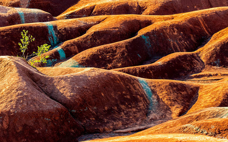
Because the rock is soft and easily weathered, erosion quickly accelerated. Water flowing over the surface carved channels, gullies, and ridges, gradually forming the distinctive badlands topography.
This makes the Cheltenham Badlands especially fascinating: the rock itself is hundreds of millions of years old, but the dramatic landscape is relatively recent, shaped largely by modern erosion processes.
Why Are the Cheltenham Badlands Red?
The striking red colour of the landscape comes from iron oxide within the Queenston Shale.
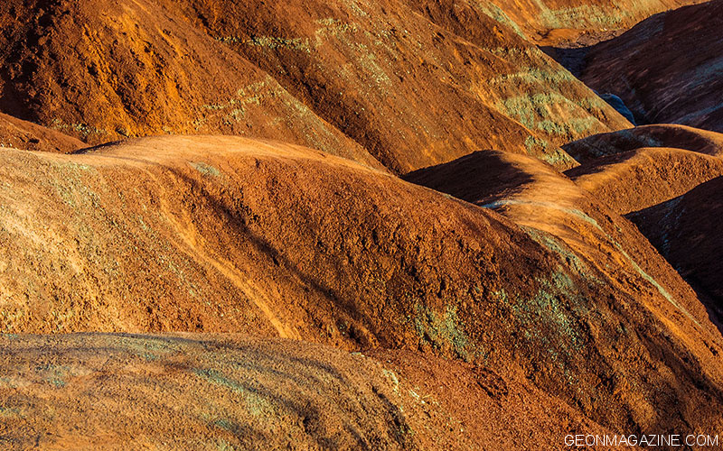
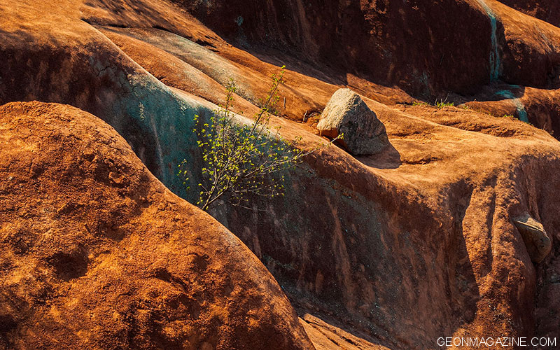
When iron-bearing minerals are exposed to oxygen, they oxidize, producing the red, orange, and rust tones that dominate the hillsides. In some areas, grey-green layers are also visible, formed by variations in groundwater flow and chemical conditions within the rock.
The result is a vivid palette of red, orange, brown, and occasional greenish tones, making the site visually unique within the Ontario landscape.
Why Is the Landscape Still Eroding?
Erosion remains one of the defining features of the Cheltenham Badlands.
The shale contains clay minerals that expand and contract with changes in moisture. Rainfall and surface runoff gradually break down the rock, while seasonal wetting and drying contribute to cracking and further instability.
Small channels formed by flowing water can deepen over time, evolving into larger erosion gullies.
Studies have shown that significant erosion has occurred in recent decades, with some areas losing several metres of surface elevation between the 1970s and the early 2000s. Human foot traffic can further accelerate this process on such a fragile surface.
For this reason, visitors are now required to stay on designated paths and viewing platforms.
Protecting the Cheltenham Badlands
As the site grew in popularity, uncontrolled visitor access began to damage the fragile shale surface.
In 2015, the Cheltenham Badlands were temporarily closed to allow for the development of a long-term protection strategy. The site reopened in 2018 with improved infrastructure, including a boardwalk, designated viewing areas, signage, and a managed parking system.
These measures were designed to balance public access with environmental protection, ensuring that visitors can experience the landscape without contributing to its degradation.
Today, access to the exposed slopes is restricted, and visitors are encouraged to observe the site from designated viewpoints. The area is managed through cooperation between the Ontario Heritage Trust and the Bruce Trail Conservancy.
Cheltenham Badlands Trail
The Cheltenham Badlands are connected to the Bruce Trail, one of Canada’s most famous long-distance hiking routes.
A short access trail leads from the Bruce Trail to the viewing area, allowing visitors to experience the unique red landscape without stepping directly onto the fragile shale.
The surrounding Bruce Trail offers a completely different natural setting, with forests, meadows, and rolling terrain typical of the Niagara Escarpment.
Visitors are strongly encouraged to remain on marked trails, as even minor disturbances can contribute to long-term erosion of the site.
A Small Landscape with a Deep Geological History
The Cheltenham Badlands offer a rare opportunity to observe multiple layers of Earth’s history in a single location.
The rocks themselves formed more than 445 million years ago in a shallow marine environment. Over time, geological forces, glaciation, and erosion shaped the broader Niagara Escarpment. Much later, human activity exposed the soft shale, allowing modern erosion to sculpt the dramatic landscape seen today.
What appears at first glance to be a barren red hillside is, in fact, a living record of ancient environments, geological transformation, and ongoing natural processes.
For visitors to Caledon and the Niagara Escarpment, the Cheltenham Badlands provide a unique and unforgettable glimpse into Earth’s deep past—written directly into the land itself.
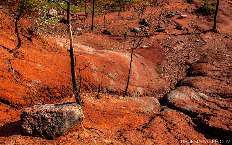
Photogallery: Cheltenham Badlands.


Visitor Information
The Cheltenham Badlands are typically open seasonally from May to November, from dawn to dusk, by reservation only. Entry is managed through a parking reservation system, and visitor capacity is limited.
Entrance fees:
Entrance fees are charged per vehicle. All transactions must be made through ParkPass. Most bookings are for 90 minutes. Limited spots are available, however, for three-hour bookings.
• Monday to Friday: $10 + HST for 90-minute visit
• Weekends and holidays: $20 + HST for 90-minute visit
• Monday to Friday: $18 + HST for three-hour visit
• Weekends and holidays: $35 + HST for three-hour visit
Portable washrooms available on site
More: Caledon Hills Bruce Trail Club
Where Are the Cheltenham Badlands?
The Cheltenham Badlands are located in Caledon, within the Greater Toronto Area, on the southeast side of Olde Base Line Road, between Creditview Road and Chinguacousy Road.
The official address is 1739 Olde Base Line Road, Caledon, Ontario. The site lies within the Niagara Escarpment region and is close to several popular outdoor destinations, including the Bruce Trail and Terra Cotta Conservation Area.
Covering approximately 36 hectares, the Cheltenham Badlands are among the most recognizable geological attractions in the region.